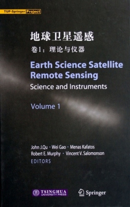
地球科学:卫星遥感技术
出版社:清华大学出版社
年代:2006
定价:
书籍简介:
卫星遥感近10年来得到越来越广泛的应用,本书介绍了美国NASA的对地观测系统(EOS)项目,该项目将已发射和即将发射的卫星组成卫星星座,从而可更全面、快捷、准确和深入地对地球系统进行观测。本书既涉及传感器又介绍了大的空间计划,如海洋观测传感器、臭氧成像光谱仪、热带雨林探测计划等。书中描述了MODIS的基本特点和技术参数,及其在海洋、陆地、大气科研方面的应用(包括专题制图、大气监测、土地覆盖与变化、大气中气溶胶浓度探测等诸多方面)。书中也介绍了多种获取遥感数据的渠道,其中如何从不同的公共机构查询、定购遥感数据对遥感数据用户很有帮助。本书还给出当今世界卫星遥感领域最新的技术与工具,给出诸如HDF-EOS的地球科学遥感数据格式与信息,评估了当前的多种数据处理方法,介绍如何搜索与定购各种来自不同公共领域的数据的方法,探究遥感信息和GIS数据的结合以及WebGIS应用。这无疑将对我国相关领域的工作起到交流促进作用。
书籍目录:
List of Contributors xv1 Introduction to Science and Instruments 2 Introduction to MODIS and an Overview of Associated Activities 3 MODIS Level-lB Products 4 MODIS Geolocation 5 Introduction to MODIS Cloud Products 6 MODIS Observation of Aerosol Loading from 2000 to 2004 7 MODIS Land Products and Data Processing 8 Operational Atmospheric Correction of MODIS Visible to Middle Infrared Land Surface Data in the Case of an Infinite ambertian Target 9 MODIS Snow and Sea Ice Products 10 The NPOESS Preparatory Project 11 The Visible Infrared Imaging Radiometer Suite 12 Conically Scanned Microwave Imager Sounder 13 Advanced Technology Microwave Sounder 14 Introduction to AIRS and CrIS
List of Contributors xv1 Introduction to Science and Instruments 2 Introduction to MODIS and an Overview of Associated Activities 3 MODIS Level-lB Products 4 MODIS Geolocation 5 Introduction to MODIS Cloud Products 6 MODIS Observation of Aerosol Loading from 2000 to 2004 7 MODIS Land Products and Data Processing 8 Operational Atmospheric Correction of MODIS Visible to Middle Infrared Land Surface Data in the Case of an Infinite ambertian Target 9 MODIS Snow and Sea Ice Products 10 The NPOESS Preparatory Project 11 The Visible Infrared Imaging Radiometer Suite 12 Conically Scanned Microwave Imager Sounder 13 Advanced Technology Microwave Sounder 14 Introduction to AIRS and CrIS 15 The Ozone Mapping and Profiler Suite 16 Estimating Solar UV-B Irradiance at the Earth's Surface Using Multi-Satellite Remote Sensing Measurements 17 Surface Rain Rates from Tropical Rainfall Measuring Mission Satellite Algorithms 18 Use of Satellite Remote Sensing Data for Modeling Carbon Emissions from Fires: A 19 TRMM Fire Algorithm, Product and Applications 20 China's Current and Future Meteorological Satellite Systems Index
内容摘要:
木门共有两卷。此为第1卷,包含20章,主要提供了有关中分辨串成像光谱仪(MODIS)产品的信息和科学应用,介绍了美国国家极轨环境卫系统(NPOESS)和NPOESS预备计划(NPP),还探讨厂其他卫星遥感装备和应用。有关数据格式、数据处理、数据查询和订购等方面的内容在第2卷中给出。 本卷论及美国宁航局(NSA)用于监测和探测地球变化的主要卫星系统——地球观测系统(EOS),EOS包括的卫星Terra、Aqua和Aura及其装载的MODIS、AIRS、AMSU、AMSR-E、OMI等遥感仪器,并讨论厂NPP将携带的4个NPOESS系统重要部件:可见光红外成像辐射组件(VIIRS),航线交叉红外探测器(CrIS),先进技术微波探测器(ATMS)以及臭氧成图和廓线仪装置(OMPS),可用于研究地球气候环境和天气变化。 本书作者均为相关领域具有权威性的专家与学者。图书内容既包括现代遥感技术的基础知识,义涉及卫星遥感的前沿领域,有广泛的实用性,可作为遥感、地学、环境、空间信息等地球科学领域的专业参考书。
书籍规格:
| 书籍详细信息 | |||
| 书名 | 地球科学:卫星遥感技术站内查询相似图书 | ||
| 9787302128441 《地球科学:卫星遥感技术》pdf扫描版电子书已有网友提供资源下载链接,请点击下方按钮查看 | |||
| 出版地 | 北京 | 出版单位 | 清华大学出版社 |
| 版次 | 1版 | 印次 | 1 |
| 定价(元) | 语种 | 英文 | |
| 尺寸 | 装帧 | 平装 | |
| 页数 | 印数 | ||
书籍信息归属:
地球科学:卫星遥感技术是清华大学出版社于2006.08出版的中图分类号为 TP72 的主题关于 卫星遥感-理论-英文 ,卫星遥感-遥感仪-英文 ,卫星遥感-遥感设备-英文 的书籍。
